
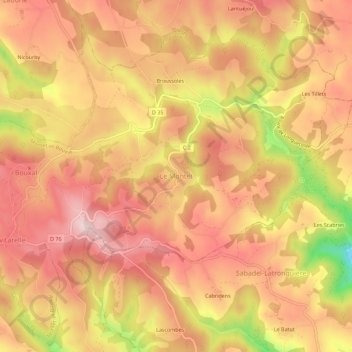
Le Montet topographic map
Interactive map
Click on the map to display elevation.
About this map
Name: Le Montet topographic map, elevation, terrain.
Average elevation: 553 m
Minimum elevation: 370 m
Maximum elevation: 643 m
Other topographic maps
Click on a map to view its topography, its elevation and its terrain.
Broussoles
France > Occitanie > Lot > Montet-et-Bouxal > Le Montet
Broussoles, Le Montet, Montet-et-Bouxal, Figeac, Lot, Occitanie, France métropolitaine, 46210, France
Average elevation: 566 m
Les Tillets
France > Occitanie > Lot > Montet-et-Bouxal > Les Tillets
Les Tillets, Montet-et-Bouxal, Figeac, Lot, Occitanie, France métropolitaine, 46210, France
Average elevation: 564 m