
Cauderoue topographic map
Interactive map
Click on the map to display elevation.
About this map
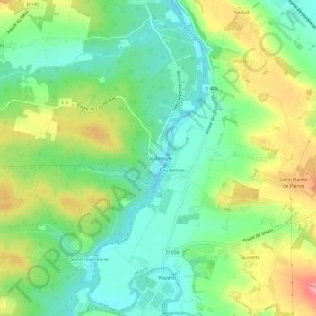
Name: Cauderoue topographic map, elevation, terrain.
Average elevation: 87 m
Minimum elevation: 44 m
Maximum elevation: 157 m
Other topographic maps
Click on a map to view its topography, its elevation and its terrain.
Le Béas
France > Nouvelle-Aquitaine > Lot-et-Garonne > Barbaste > Le Béas
Le Béas, Barbaste, Nérac, Lot-et-Garonne, Nouvelle-Aquitaine, France métropolitaine, 47230, France
Average elevation: 96 m