
Törpin topographic map
Interactive map
Click on the map to display elevation.
About this map
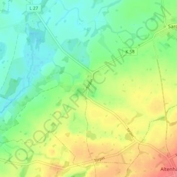
Name: Törpin topographic map, elevation, terrain.
Average elevation: 54 m
Minimum elevation: 30 m
Maximum elevation: 90 m
Other topographic maps
Click on a map to view its topography, its elevation and its terrain.
Gehmkow
Deutschland > Mecklenburg-Vorpommern > Mecklenburgische Seenplatte > Sarow
Gehmkow, Sarow, Demmin-Land, Mecklenburgische Seenplatte, Mecklenburg-Vorpommern, 17111, Deutschland
Average elevation: 43 m
Ganschendorf
Deutschland > Mecklenburg-Vorpommern > Mecklenburgische Seenplatte > Sarow
Ganschendorf, Sarow, Demmin-Land, Mecklenburgische Seenplatte, Mecklenburg-Vorpommern, Deutschland
Average elevation: 44 m