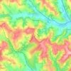
Kosmaj topographic map
Click on the map to display elevation.
Kosmaj
Kosmaj (Serbian Cyrillic: Космај, pronounced [kɔ̌smaːj]) is a mountain south of Belgrade. With an elevation of 626 meters, it is the highest point of the entire Belgrade City area and is nicknamed one of two "Belgrade mountains" (the other being the mountain of Avala).
About this map

Name: Kosmaj topographic map, elevation, terrain.
Average elevation: 398 m
Minimum elevation: 254 m
Maximum elevation: 615 m
Other topographic maps
Click on a map to view its topography, its elevation and its terrain.