
Tote topographic map
Interactive map
Click on the map to display elevation.
About this map
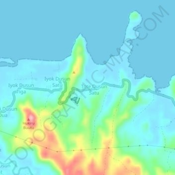
Name: Tote topographic map, elevation, terrain.
Location: Tote, Bolaang Mongondow Utara, Nord-Sulawesi, Indonesien (0.88280 123.31960 0.92280 123.35960)
Average elevation: 26 m
Minimum elevation: 0 m
Maximum elevation: 150 m