
花山街道 topographic map
Interactive map
Click on the map to display elevation.
About this map
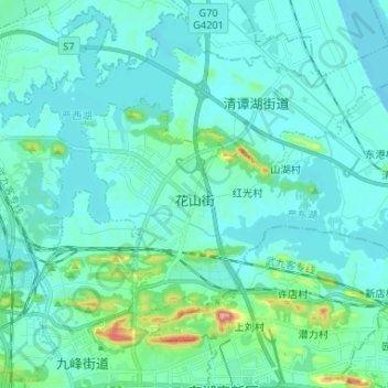
Name: 花山街道 topographic map, elevation, terrain.
Location: 花山街道, 东湖新技术开发区(托管), 洪山区, 武汉市, 湖北省, 中国 (30.51171 114.47775 30.58229 114.60889)
Average elevation: 35 m
Minimum elevation: 12 m
Maximum elevation: 187 m
Other topographic maps
Click on a map to view its topography, its elevation and its terrain.
山水公园
中国 > 湖北省 > 东湖新技术开发区(托管) > 九峰街道
山水公园, 九峰街道, 东湖新技术开发区(托管), 洪山区, 武汉市, 湖北省, 中国
Average elevation: 52 m