Linda-a-Velha topographic map
Interactive map
Click on the map to display elevation.
About this map
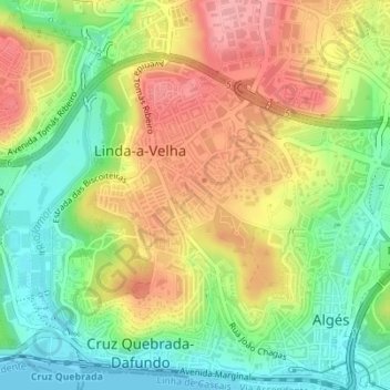
Name: Linda-a-Velha topographic map, elevation, terrain.
Average elevation: 54 m
Minimum elevation: 0 m
Maximum elevation: 114 m

Click on the map to display elevation.
Name: Linda-a-Velha topographic map, elevation, terrain.
Average elevation: 54 m
Minimum elevation: 0 m
Maximum elevation: 114 m