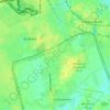
Potsdam topographic map
Click on the map to display elevation.
Potsdam
The traditional towns in the governorate were small, however, in the course of the industrial labour migration some reached the rank of urban districts. The principal towns were Brandenburg upon Havel, Köpenick, Potsdam, Prenzlau, Spandau and Ruppin. Until 1875 Berlin also was a town within the governorate. After its disentanglement a number of its suburbs outside Berlin's municipal borders grew to towns, many forming urban Bezirke within the governorate of Potsdam such as Charlottenburg, Lichtenberg, Rixdorf (after 1912 Neukölln), and Schöneberg (all of which, as well as Köpenick and Spandau, incorporated into Greater Berlin in 1920). The urban Bezirke were (years indicating the elevation to rank of urban Bezirk or affiliation with Potsdam governorate, respectively).
About this map
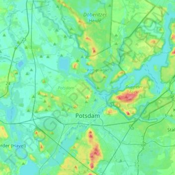
Name: Potsdam topographic map, elevation, terrain.
Location: Potsdam, Brandenburg, Germany (52.34204 12.88678 52.51469 13.16819)
Average elevation: 40 m
Minimum elevation: 25 m
Maximum elevation: 103 m
Other topographic maps
Click on a map to view its topography, its elevation and its terrain.

Potsdam
Germany > Brandenburg > Potsdam
The traditional towns in the governorate were small, however, in the course of the industrial labour migration some reached the rank of urban districts. The principal towns were Brandenburg upon Havel, Köpenick, Potsdam, Prenzlau, Spandau and Ruppin. Until 1875 Berlin also was a town within the governorate.…
Average elevation: 43 m
North European Plain
Germany > Brandenburg > Ostprignitz-Ruppin > Lindow (Mark) > Banzendorf
Elevations vary between 0 and 200 m (0 to about 650 ft). While mostly used as farmland, the region also contains bogs, heath and lakes. The Wadden Sea, a large tidal area, is located on the North Sea coast.
Average elevation: 54 m
North European Plain
Germany > Brandenburg > Ostprignitz-Ruppin > Lindow (Mark) > Banzendorf
Elevations vary between 0 and 200 m (0 to about 650 ft). While mostly used as farmland, the region also contains bogs, heath and lakes. The Wadden Sea, a large tidal area, is located on the North Sea coast.
Average elevation: 54 m
Groß Gastrose - Wjeliki Gósćeraz
Germany > Brandenburg > Spree-Neiße - Sprjewja-Nysa
Average elevation: 59 m

Preilack - Pśiłuk
Germany > Brandenburg > Spree-Neiße - Sprjewja-Nysa > Turnow-Preilack
Average elevation: 66 m
Birkenstein
Germany > Brandenburg > Märkisch-Oderland > Hoppegarten > Dahlwitz-Hoppegarten
Average elevation: 55 m

Siedlung Waldesruh
Germany > Brandenburg > Dahme-Spreewald > Königs Wusterhausen
Average elevation: 41 m