
先遣乡 topographic map
Interactive map
Click on the map to display elevation.
About this map
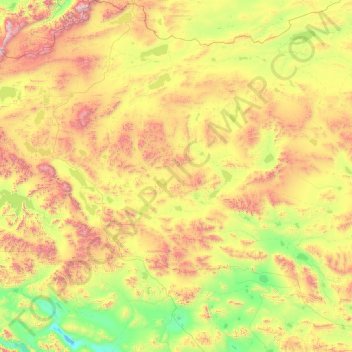
Name: 先遣乡 topographic map, elevation, terrain.
Location: 先遣乡, 改则县, 阿里地区, 西藏自治区, 中国 (32.73097 81.98199 35.71796 83.84113)
Average elevation: 5,074 m
Minimum elevation: 4,376 m
Maximum elevation: 6,908 m
Other topographic maps
Click on a map to view its topography, its elevation and its terrain.