
Bachalpsee topographic map
Interactive map
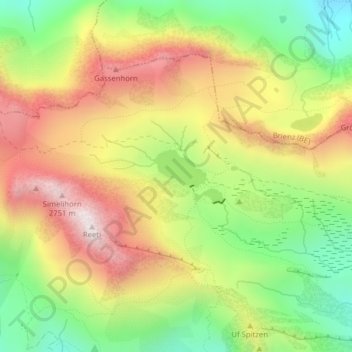
Click on the map to display elevation.
About this map
Name: Bachalpsee topographic map, elevation, terrain.
Average elevation: 2,320 m
Minimum elevation: 1,936 m
Maximum elevation: 2,728 m
Other topographic maps
Click on a map to view its topography, its elevation and its terrain.
Unterer Grindelwaldgletscher
Schweiz > Bern > Grindelwald
Unterer Grindelwaldgletscher, Gesicherter Steig zur Schreckhornhütte, Grindelwald, Verwaltungskreis Interlaken-Oberhasli, Verwaltungsregion Oberland, Bern, Schweiz
Average elevation: 2,026 m