
勐宋乡 topographic map
Interactive map
Click on the map to display elevation.
About this map
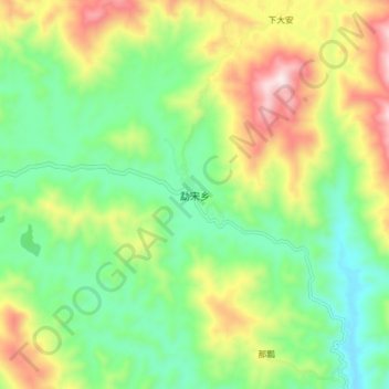
Name: 勐宋乡 topographic map, elevation, terrain.
Location: 勐宋乡, 勐海县, 西双版纳傣族自治州, 云南省, 666100, 中国 (22.01460 100.52334 22.09460 100.60334)
Average elevation: 1,347 m
Minimum elevation: 1,103 m
Maximum elevation: 1,762 m
Other topographic maps
Click on a map to view its topography, its elevation and its terrain.