
Val-de-Vière topographic map
Interactive map
Click on the map to display elevation.
About this map
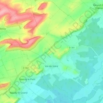
Name: Val-de-Vière topographic map, elevation, terrain.
Average elevation: 142 m
Minimum elevation: 105 m
Maximum elevation: 221 m
Other topographic maps
Click on a map to view its topography, its elevation and its terrain.
Rosay
France > Grand Est > Marne > Val-de-Vière
Rosay, Val-de-Vière, Vitry-le-François, Marne, Grand Est, France métropolitaine, 51340, France
Average elevation: 132 m