
Estherville topographic map
Interactive map
Click on the map to display elevation.
About this map
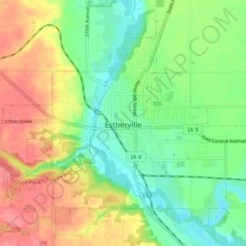
Name: Estherville topographic map, elevation, terrain.
Location: Estherville, Emmet County, Iowa, 51334, United States (43.38141 -94.87141 43.42466 -94.80003)
Average elevation: 411 m
Minimum elevation: 380 m
Maximum elevation: 451 m
Other topographic maps
Click on a map to view its topography, its elevation and its terrain.
Wallingford
United States > Iowa > Emmet County
Wallingford, Emmet County, Iowa, United States
Average elevation: 398 m