
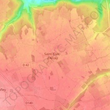
Saint-Clair-d'Arcey topographic map
Interactive map
Click on the map to display elevation.
About this map
Name: Saint-Clair-d'Arcey topographic map, elevation, terrain.
Average elevation: 155 m
Minimum elevation: 93 m
Maximum elevation: 173 m
Other topographic maps
Click on a map to view its topography, its elevation and its terrain.
Treis-Sants-en-Ouche
France > Normandie > Eure > Treis-Sants-en-Ouche
Treis-Sants-en-Ouche, Bernay, Eure, Normandie, France métropolitaine, France
Average elevation: 153 m