
Le Pouyaou topographic map
Interactive map
Click on the map to display elevation.
About this map
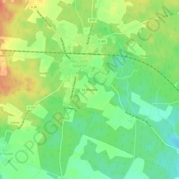
Name: Le Pouyaou topographic map, elevation, terrain.
Average elevation: 70 m
Minimum elevation: 46 m
Maximum elevation: 100 m
Other topographic maps
Click on a map to view its topography, its elevation and its terrain.
Le Gourgot
France > Nouvelle-Aquitaine > Landes > Ygos-Saint-Saturnin > Le Gourgot
Le Gourgot, Ygos-Saint-Saturnin, Mont-de-Marsan, Landes, Nouvelle-Aquitaine, France métropolitaine, 40110, France
Average elevation: 76 m