
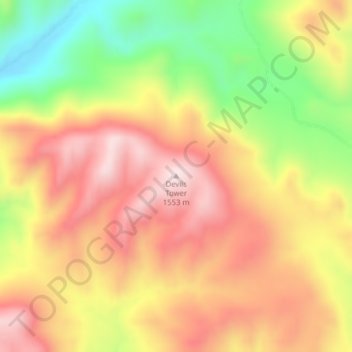
Devils Tower topographic map
Interactive map
Click on the map to display elevation.
About this map
Name: Devils Tower topographic map, elevation, terrain.
Average elevation: 1,373 m
Minimum elevation: 1,146 m
Maximum elevation: 1,550 m
Other topographic maps
Click on a map to view its topography, its elevation and its terrain.
Helena
Vereinigte Staaten von Amerika > Montana > Lewis and Clark County
Helena, Lewis and Clark County, Montana, Vereinigte Staaten von Amerika
Average elevation: 1,296 m
Helena
Vereinigte Staaten von Amerika > Montana > Lewis and Clark County > Helena
Helena, Lewis and Clark County, Montana, 59624, Vereinigte Staaten von Amerika
Average elevation: 1,423 m