
Thank you for supporting this site ❤️
Make a donation
Make a donation
Farmie topographic map
Click on the map to display elevation.
Thank you for supporting this site ❤️
Make a donation
Make a donation
About this map
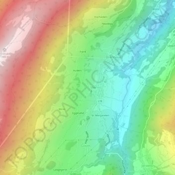
Name: Farmie topographic map, elevation, terrain.
Location: Farmie, Brennwald, Wenns, Bezirk Imst, Tyrol, 6473, Austria (47.14899 10.70691 47.18899 10.74691)
Average elevation: 1,286 m
Minimum elevation: 785 m
Maximum elevation: 2,008 m
Thank you for supporting this site ❤️
Make a donation
Make a donation