
Le Magnoux topographic map
Interactive map
Click on the map to display elevation.
About this map
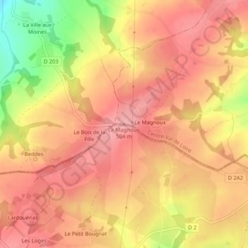
Name: Le Magnoux topographic map, elevation, terrain.
Average elevation: 466 m
Minimum elevation: 385 m
Maximum elevation: 502 m
Other topographic maps
Click on a map to view its topography, its elevation and its terrain.
Deguilly
France > Centre-Val de Loire > Cher > Préveranges > Deguilly
Deguilly, Préveranges, Saint-Amand-Montrond, Cher, Centre-Val de Loire, France métropolitaine, 18370, France
Average elevation: 445 m