
Duval County topographic map
Interactive map
Click on the map to display elevation.
About this map
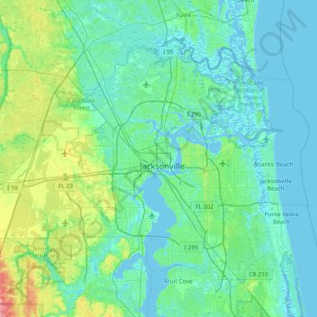
Name: Duval County topographic map, elevation, terrain.
Location: Duval County, Florida, USA (30.10375 -82.04950 30.58620 -81.31671)
Average elevation: 11 m
Minimum elevation: -5 m
Maximum elevation: 69 m
Other topographic maps
Click on a map to view its topography, its elevation and its terrain.