
Dubai topographic map
Interactive map
Click on the map to display elevation.
Dubai
Dubai's topography is characterized by its location within the Arabian Desert, featuring predominantly flat, sandy terrain interspersed with unique geological formations. The city's landscape is highlighted by fine, white sands composed mainly of crushed shell and coral. To the east, salt-crusted coastal plains, known as sabkha, transition into a series of north–south running dunes, which increase in size and exhibit a reddish hue due to iron oxide content. Further east, the flat desert gives way to the rugged Western Hajar Mountains near Hatta, where peaks can reach elevations of approximately 1,300 meters (4,265 feet), presenting an arid and jagged terrain. Additionally, Dubai Creek, a natural inlet, extends into the city, forming a natural port that has been integral to trade and transport.
About this map
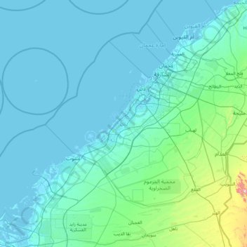
Name: Dubai topographic map, elevation, terrain.
Average elevation: 64 m
Minimum elevation: -9 m
Maximum elevation: 1,042 m