
Vessey topographic map
Interactive map
Click on the map to display elevation.
About this map
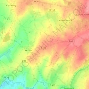
Name: Vessey topographic map, elevation, terrain.
Average elevation: 56 m
Minimum elevation: 12 m
Maximum elevation: 90 m
Other topographic maps
Click on a map to view its topography, its elevation and its terrain.
La Caserne
France > Normandie > Manche > Pontorson
La Caserne, Ardevon, Pontorson, Avranches, Manche, Normandie, France métropolitaine, 50170, France
Average elevation: 6 m
Les Hautes Rivières
France > Normandie > Manche > Pontorson
Les Hautes Rivières, Moidrey, Pontorson, Avranches, Manche, Normandie, France métropolitaine, 50170, France
Average elevation: 21 m