
Thank you for supporting this site ❤️
Make a donation
Make a donation
Galgamuwa topographic map
Click on the map to display elevation.
Thank you for supporting this site ❤️
Make a donation
Make a donation
About this map
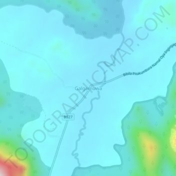
Name: Galgamuwa topographic map, elevation, terrain.
Location: Galgamuwa, Monaragala District, Uva Province, Sri Lanka (7.29118 81.37280 7.33118 81.41280)
Average elevation: 145 m
Minimum elevation: 93 m
Maximum elevation: 653 m
Thank you for supporting this site ❤️
Make a donation
Make a donation
Other topographic maps
Click on a map to view its topography, its elevation and its terrain.