
Littlefield topographic map
Interactive map
Click on the map to display elevation.
About this map
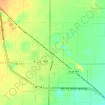
Name: Littlefield topographic map, elevation, terrain.
Location: Littlefield, Lamb County, Texas, United States (33.89586 -102.36329 33.95159 -102.29210)
Average elevation: 1,085 m
Minimum elevation: 1,066 m
Maximum elevation: 1,101 m
Other topographic maps
Click on a map to view its topography, its elevation and its terrain.
Earth
United States > Texas > Lamb County
Earth, Lamb County, Texas, United States
Average elevation: 1,130 m
Littlefield
United States > Texas > Lamb County > Littlefield > Littlefield
Littlefield, Lamb County, Texas, United States
Average elevation: 1,084 m