
Thank you for supporting this site ❤️
Make a donation
Make a donation
Adolfsfors topographic map
Click on the map to display elevation.
Thank you for supporting this site ❤️
Make a donation
Make a donation
About this map
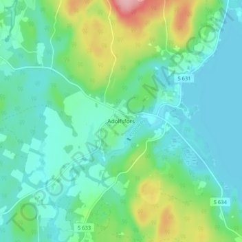
Name: Adolfsfors topographic map, elevation, terrain.
Location: Adolfsfors, Eda kommun, Värmland County, Sweden (59.78012 12.20592 59.82012 12.24592)
Average elevation: 122 m
Minimum elevation: 86 m
Maximum elevation: 236 m
Thank you for supporting this site ❤️
Make a donation
Make a donation