
Thank you for supporting this site ❤️
Make a donation
Make a donation
Melbourne topographic map
Click on the map to display elevation.
Thank you for supporting this site ❤️
Make a donation
Make a donation
About this map
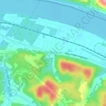
Name: Melbourne topographic map, elevation, terrain.
Location: Melbourne, Campbell County, Kentucky, United States (39.01997 -84.38450 39.03924 -84.35607)
Average elevation: 168 m
Minimum elevation: 143 m
Maximum elevation: 249 m
Thank you for supporting this site ❤️
Make a donation
Make a donation
Other topographic maps
Click on a map to view its topography, its elevation and its terrain.