
Thank you for supporting this site ❤️
Make a donation
Make a donation
Alvarenga topographic map
Click on the map to display elevation.
Thank you for supporting this site ❤️
Make a donation
Make a donation
About this map
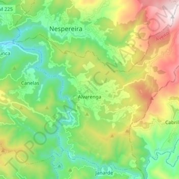
Name: Alvarenga topographic map, elevation, terrain.
Location: Alvarenga, Arouca, Aveiro, Portugal (40.92463 -8.21341 41.01369 -8.08917)
Average elevation: 467 m
Minimum elevation: 75 m
Maximum elevation: 1,219 m
Thank you for supporting this site ❤️
Make a donation
Make a donation
Other topographic maps
Click on a map to view its topography, its elevation and its terrain.