
Storkow (Mark) topographic map
Interactive map
Click on the map to display elevation.
About this map
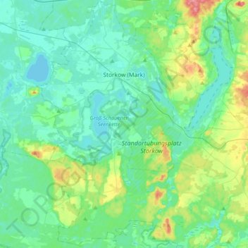
Name: Storkow (Mark) topographic map, elevation, terrain.
Location: Storkow (Mark), Oder-Spree, Brandebourg, 15859, Allemagne (52.11582 13.81751 52.31149 14.06661)
Average elevation: 50 m
Minimum elevation: 31 m
Maximum elevation: 120 m