
Fort McMurray topographic map
Interactive map
Click on the map to display elevation.
Fort McMurray
The community lies at a lower elevation than most other parts of Alberta, so under the right conditions it can be a "hot spot" for Alberta, or even all of Canada (as in April 1980 when its daily mean temperature of 10 °C (50 °F) was unsurpassed by any other Canadian station).
About this map
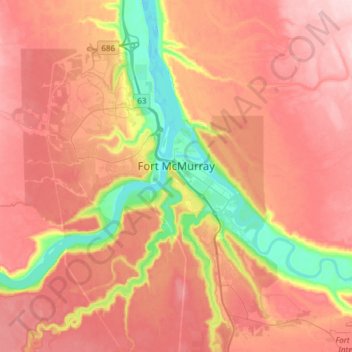
Name: Fort McMurray topographic map, elevation, terrain.
Location: Fort McMurray, Wood Buffalo, Alberta, Canada (56.64375 -111.51094 56.80447 -111.20705)
Average elevation: 345 m
Minimum elevation: 234 m
Maximum elevation: 422 m