
Le Guémadeuc topographic map
Interactive map
Click on the map to display elevation.
About this map
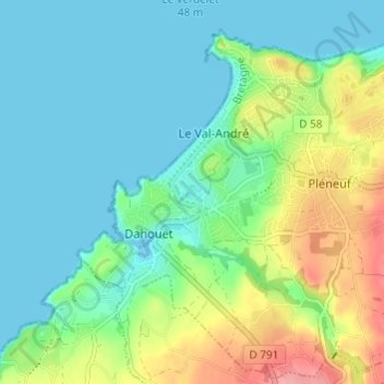
Name: Le Guémadeuc topographic map, elevation, terrain.
Average elevation: 28 m
Minimum elevation: -1 m
Maximum elevation: 96 m
Other topographic maps
Click on a map to view its topography, its elevation and its terrain.
Piégu
France > Bretagne > Côtes-d'Armor > Pléneuf-Val-André > Le Val-André
Piégu, Le Val-André, Pléneuf-Val-André, Saint-Brieuc, Côtes-d'Armor, Bretagne, France métropolitaine, 22370, France
Average elevation: 13 m