
okres Bratislava II topographic map
Interactive map
Click on the map to display elevation.
About this map
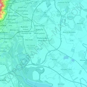
Name: okres Bratislava II topographic map, elevation, terrain.
Location: okres Bratislava II, Bratislava, Bratislavský kraj, Slowakije (48.05380 17.11737 48.19175 17.28453)
Average elevation: 134 m
Minimum elevation: 118 m
Maximum elevation: 367 m