
Grande Comore topographic map
Interactive map
Click on the map to display elevation.
About this map
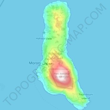
Name: Grande Comore topographic map, elevation, terrain.
Location: Grande Comore, Comoros (-11.93961 43.22874 -11.36553 43.51805)
Average elevation: 148 m
Minimum elevation: -2 m
Maximum elevation: 2,348 m