
Borjád topographic map
Interactive map
Click on the map to display elevation.
About this map
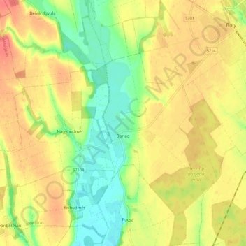
Name: Borjád topographic map, elevation, terrain.
Location: Borjád, Bólyi járás, Komitat Baranya, Südtransdanubien, Ungarn (45.90133 18.45277 45.97692 18.51011)
Average elevation: 131 m
Minimum elevation: 99 m
Maximum elevation: 158 m