
Thank you for supporting this site ❤️
Make a donation
Make a donation
Cercal topographic map
Click on the map to display elevation.
Thank you for supporting this site ❤️
Make a donation
Make a donation
About this map
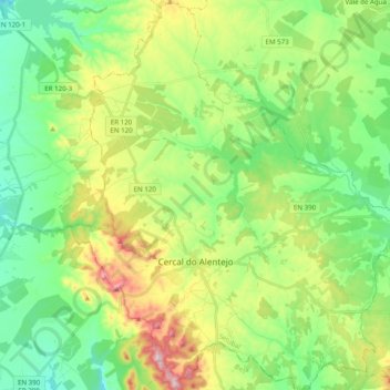
Name: Cercal topographic map, elevation, terrain.
Location: Cercal, Santiago do Cacém, Setúbal, Portugal (37.74939 -8.73573 37.90450 -8.56546)
Average elevation: 135 m
Minimum elevation: 25 m
Maximum elevation: 356 m
Thank you for supporting this site ❤️
Make a donation
Make a donation
Other topographic maps
Click on a map to view its topography, its elevation and its terrain.