
Thank you for supporting this site ❤️
Make a donation
Make a donation
Sahraoui topographic map
Click on the map to display elevation.
Thank you for supporting this site ❤️
Make a donation
Make a donation
About this map
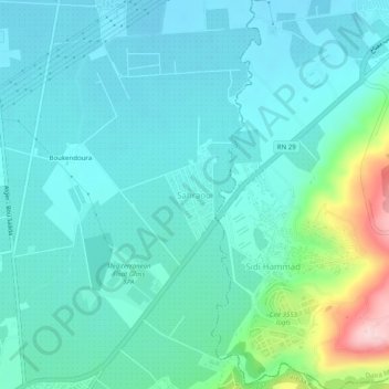
Name: Sahraoui topographic map, elevation, terrain.
Location: Sahraoui, Larbaa, Daïra Larbâa, Blida, 09300, Algérie (36.57458 3.15866 36.61458 3.19866)
Average elevation: 90 m
Minimum elevation: 47 m
Maximum elevation: 282 m
Thank you for supporting this site ❤️
Make a donation
Make a donation