
普兰镇 topographic map
Interactive map
Click on the map to display elevation.
About this map
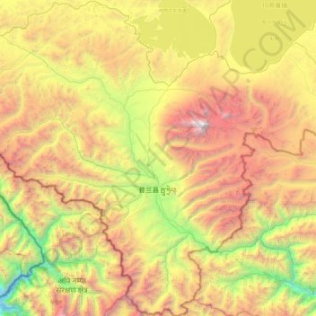
Name: 普兰镇 topographic map, elevation, terrain.
Location: 普兰镇, རྩ་མདའ་རྫོང་ 普兰县, མངའ་རིས་ས་ཁུལ་ 阿里地区, Tibet, China (30.00737 80.68585 30.72133 81.48063)
Average elevation: 4,808 m
Minimum elevation: 2,798 m
Maximum elevation: 7,639 m