
Beni Mensour topographic map
Interactive map
Click on the map to display elevation.
About this map
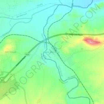
Name: Beni Mensour topographic map, elevation, terrain.
Location: Beni Mensour, Boudjellil, Daïra Tazmalt, Béjaïa, 06000, Algérie (36.31554 4.33417 36.35554 4.37417)
Average elevation: 302 m
Minimum elevation: 253 m
Maximum elevation: 420 m
Other topographic maps
Click on a map to view its topography, its elevation and its terrain.
Tala Elbir
Algérie > Béjaïa > Daïra Tazmalt > Boudjellil
Tala Elbir, Boudjellil, Daïra Tazmalt, Béjaïa, 06000, Algérie
Average elevation: 403 m
Tigrine
Algérie > Béjaïa > Daïra Tazmalt > Boudjellil > Tigrine
Tigrine, Boudjellil, Daïra Tazmalt, Béjaïa, 06000, Algérie
Average elevation: 681 m