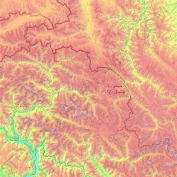
达布达尔乡 topographic map
Interactive map
Click on the map to display elevation.
About this map
Name: 达布达尔乡 topographic map, elevation, terrain.
Average elevation: 4,416 m
Minimum elevation: 1,299 m
Maximum elevation: 8,508 m

Click on the map to display elevation.
Name: 达布达尔乡 topographic map, elevation, terrain.
Average elevation: 4,416 m
Minimum elevation: 1,299 m
Maximum elevation: 8,508 m