
Thank you for supporting this site ❤️
Make a donation
Make a donation
Harlingen topographic map
Click on the map to display elevation.
Thank you for supporting this site ❤️
Make a donation
Make a donation
About this map
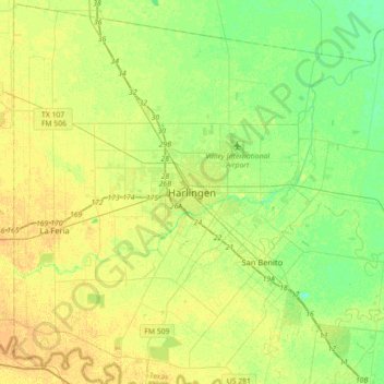
Name: Harlingen topographic map, elevation, terrain.
Location: Harlingen, Cameron County, Texas, 78550, United States (26.03075 -97.85606 26.35075 -97.53606)
Average elevation: 14 m
Minimum elevation: 2 m
Maximum elevation: 24 m
Thank you for supporting this site ❤️
Make a donation
Make a donation