
元阳县 topographic map
Interactive map
Click on the map to display elevation.
About this map
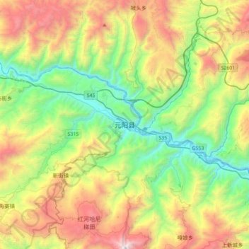
Name: 元阳县 topographic map, elevation, terrain.
Location: 元阳县, 红河哈尼族彝族自治州, 云南省, 中国 (23.06346 102.67437 23.38346 102.99437)
Average elevation: 1,171 m
Minimum elevation: 195 m
Maximum elevation: 2,849 m
Other topographic maps
Click on a map to view its topography, its elevation and its terrain.