
Thank you for supporting this site ❤️
Make a donation
Make a donation
Hepscheid topographic map
Click on the map to display elevation.
Thank you for supporting this site ❤️
Make a donation
Make a donation
About this map
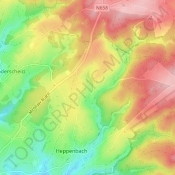
Name: Hepscheid topographic map, elevation, terrain.
Location: Hepscheid, Amblève, Verviers, Liège, Wallonie, 4771, Belgique (50.35768 6.20455 50.39768 6.24455)
Average elevation: 552 m
Minimum elevation: 474 m
Maximum elevation: 628 m
Thank you for supporting this site ❤️
Make a donation
Make a donation