
Waal topographic map
Interactive map
Click on the map to display elevation.
About this map
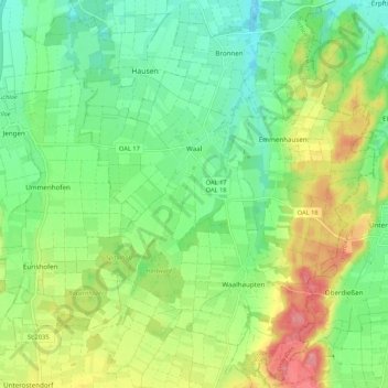
Name: Waal topographic map, elevation, terrain.
Location: Waal, Buchloe, Landkreis Ostallgäu, Bayern, 86875, Deutschland (47.95140 10.74482 48.02290 10.82638)
Average elevation: 651 m
Minimum elevation: 613 m
Maximum elevation: 716 m