
Huatta topographic map
Interactive map
Click on the map to display elevation.
About this map
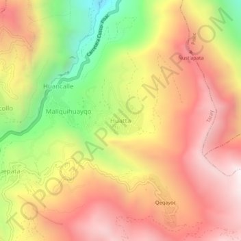
Name: Huatta topographic map, elevation, terrain.
Location: Huatta, Taray, Calca, Cusco, 08106, Perú (-13.47736 -71.88621 -13.43736 -71.84621)
Average elevation: 3,817 m
Minimum elevation: 3,051 m
Maximum elevation: 4,393 m