
Thank you for supporting this site ❤️
Make a donation
Make a donation
Eltville am Rhein topographic map
Click on the map to display elevation.
Thank you for supporting this site ❤️
Make a donation
Make a donation
About this map
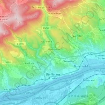
Name: Eltville am Rhein topographic map, elevation, terrain.
Location: Eltville am Rhein, Rheingau-Taunus-Kreis, Hesse, Germany (50.00509 8.00292 50.09499 8.15827)
Average elevation: 217 m
Minimum elevation: 79 m
Maximum elevation: 561 m
Thank you for supporting this site ❤️
Make a donation
Make a donation