
Ban Tat Kloi topographic map
Interactive map
Click on the map to display elevation.
About this map
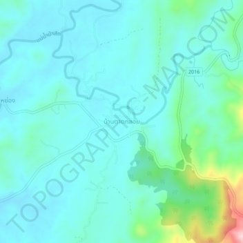
Name: Ban Tat Kloi topographic map, elevation, terrain.
Location: Ban Tat Kloi, Phetchabun Province, Thailand (16.98095 101.35379 17.02095 101.39379)
Average elevation: 241 m
Minimum elevation: 192 m
Maximum elevation: 490 m