
Thank you for supporting this site ❤️
Make a donation
Make a donation
Horton topographic map
Click on the map to display elevation.
Thank you for supporting this site ❤️
Make a donation
Make a donation
About this map
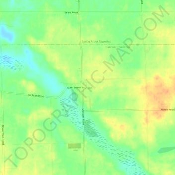
Name: Horton topographic map, elevation, terrain.
Average elevation: 318 m
Minimum elevation: 299 m
Maximum elevation: 336 m
Thank you for supporting this site ❤️
Make a donation
Make a donation
Other topographic maps
Click on a map to view its topography, its elevation and its terrain.
Waterloo State Recreation Area
United States > Michigan > Jackson County > Chelsea
Average elevation: 290 m
Thank you for supporting this site ❤️
Make a donation
Make a donation
Thank you for supporting this site ❤️
Make a donation
Make a donation
Thank you for supporting this site ❤️
Make a donation
Make a donation
Thank you for supporting this site ❤️
Make a donation
Make a donation