
Thank you for supporting this site ❤️
Make a donation
Make a donation
Jabal Sanah topographic map
Click on the map to display elevation.
Thank you for supporting this site ❤️
Make a donation
Make a donation
About this map
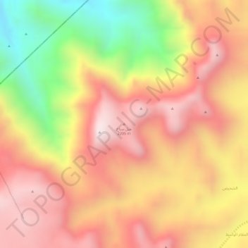
Name: Jabal Sanah topographic map, elevation, terrain.
Location: Jabal Sanah, Bart Al Anan district, Al Jawf Governorate, Yemen (16.91379 44.35556 16.91389 44.35566)
Average elevation: 1,987 m
Minimum elevation: 1,580 m
Maximum elevation: 2,234 m
Thank you for supporting this site ❤️
Make a donation
Make a donation
Other topographic maps
Click on a map to view its topography, its elevation and its terrain.