
Thank you for supporting this site ❤️
Make a donation
Make a donation
Ponte do Sótão topographic map
Click on the map to display elevation.
Thank you for supporting this site ❤️
Make a donation
Make a donation
About this map
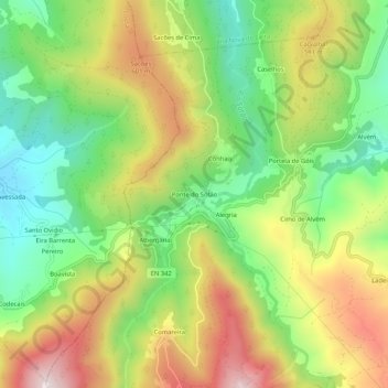
Name: Ponte do Sótão topographic map, elevation, terrain.
Location: Ponte do Sótão, Góis, Coimbra, 3330-355, Portugal (40.12134 -8.16957 40.16134 -8.12957)
Average elevation: 435 m
Minimum elevation: 175 m
Maximum elevation: 767 m
Thank you for supporting this site ❤️
Make a donation
Make a donation
Other topographic maps
Click on a map to view its topography, its elevation and its terrain.