
Thank you for supporting this site ❤️
Make a donation
Make a donation
Rémersdael topographic map
Click on the map to display elevation.
Thank you for supporting this site ❤️
Make a donation
Make a donation
About this map
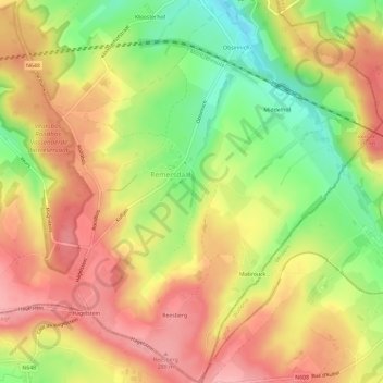
Name: Rémersdael topographic map, elevation, terrain.
Location: Rémersdael, Fourons, Tongres, Limbourg, Flandre, 3791, Belgique (50.70986 5.85653 50.74693 5.91111)
Average elevation: 235 m
Minimum elevation: 163 m
Maximum elevation: 291 m
Thank you for supporting this site ❤️
Make a donation
Make a donation
Other topographic maps
Click on a map to view its topography, its elevation and its terrain.
Thank you for supporting this site ❤️
Make a donation
Make a donation
Thank you for supporting this site ❤️
Make a donation
Make a donation