
Lusby topographic map
Interactive map
Click on the map to display elevation.
About this map
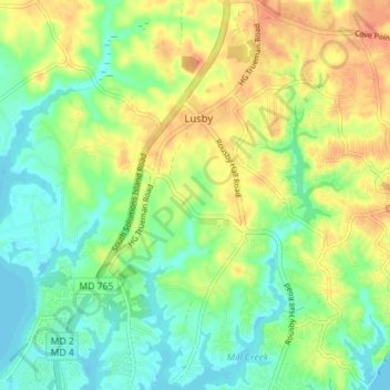
Name: Lusby topographic map, elevation, terrain.
Location: Lusby, Calvert County, Maryland, United States (38.33372 -76.45958 38.38872 -76.40869)
Average elevation: 19 m
Minimum elevation: -2 m
Maximum elevation: 43 m
Other topographic maps
Click on a map to view its topography, its elevation and its terrain.
Calvert Cliffs State Park
United States > Maryland > Calvert County > Lusby
Calvert Cliffs State Park, Lusby, Calvert County, Maryland, 20657, United States
Average elevation: 23 m