
Thank you for supporting this site ❤️
Make a donation
Make a donation
Ronse topographic map
Click on the map to display elevation.
Thank you for supporting this site ❤️
Make a donation
Make a donation
About this map
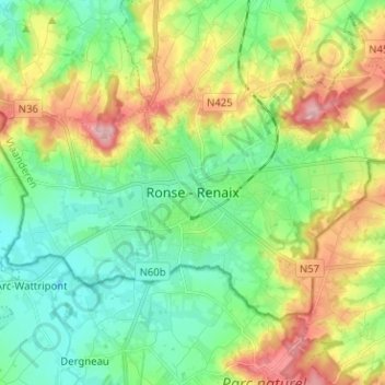
Name: Ronse topographic map, elevation, terrain.
Location: Ronse, Oudenaarde, Oost-Vlaanderen, Vlaanderen, 9600, België (50.70755 3.56209 50.78755 3.64209)
Average elevation: 62 m
Minimum elevation: 12 m
Maximum elevation: 154 m
Thank you for supporting this site ❤️
Make a donation
Make a donation